
Graham Neighbors by Source
No county office publishes a ready-made block roster. Instead, several records answer different parts of the question. Graham is an unincorporated community, so Pierce County maps and rolls supply the main public evidence. Start with the target address, limit the work to nearby parcels, and keep the access rule beside each source.
| Source | What It Shows About a Block | Access |
|---|---|---|
| Pierce PublicGIS | Adjacent parcels, roads, districts, schools, utilities and hazards | Free map; click polygons |
| Pierce ATIP | Owner or taxpayer plus situs and mailing lines per parcel | Free parcel search |
| Pierce PALS | Permits, inspections, applications and code cases at a site | Address or parcel search |
| Voter-file request | Permitted voter, precinct and district fields | Restricted request product |
| Community groups | Public leaders, meetings and service links | Public contacts, no full roster |
Property ownership is the firmest name connection in the table, but it is not proof of who sleeps in the home. The situs line is the physical parcel address. The mailing line is where tax notices go. A renter, child, guest, or other household member will not be listed on a parcel card.
Map Graham Neighbors Parcel by Parcel
The verified PublicGIS method is manual adjacency. A radius or buffer control was not confirmed in official documentation, so do not promise one. Clicking the polygons that share a boundary or road frontage creates a small, auditable set of parcels.
- Search the target Graham address in PublicGIS and turn on parcel and road layers.
- Click the target polygon. Save its parcel number and note the map date.
- Click each polygon that shares a boundary or road frontage. Record every parcel ID separately.
- Open each parcel number in ATIP and label the owner, taxpayer, situs, and mailing fields exactly.
- Use PALS only for site permits or code records. Do not treat an applicant as an occupant.
This flow stays focused on the immediate block. For every property along a full road, use the Graham street directory workflow, which follows the broader address chain.
Layer the Graham Neighbor Map
PublicGIS documents environmental, parcel, places-of-interest, school, political, public-safety, transportation, and utility layers. Switch them on one at a time. A road, creek, school line, fire boundary, or utility district can separate close parcels. The nearest Graham neighbor may therefore receive service from a different district.
Use the map's metadata or open-data control to read a layer's definition and date before relying on it. Save the layer name with the parcel notes. A zoning line explains land rules, and a school line explains service geography. Neither proves who resides on either side.
- Parcel
- A mapped land account with its own number and boundaries.
- Situs address
- The physical address assigned to the parcel or structure.
- Mailing address
- The destination for tax notices, which may be elsewhere.
- Metadata
- Information about a map layer's source, meaning, and date.
Compare Graham Neighbor Parcels
Two parcels that look like one yard can have separate accounts and legal descriptions. One rural tract may also contain several improvements, or an E911-only address may mark vacant land. Record unknown when ATIP does not disclose a person. Do not fill the blank from assumptions about surnames, shared driveways, or mailboxes.
Compare the owner or taxpayer line with the situs and mailing destinations. An out-of-area mailing line can show where tax correspondence goes, not where the owner lives. Trusts, estates, lenders, and entities may appear in property records. If an entity owns a Graham parcel, Washington CCFS may explain its public filing role, but the registered agent is still not a presumed resident.
Note: Map adjacency shows spatial closeness only; it does not prove shared ownership, family ties, or a common household.
Graham Block Permits and Cases
PALS adds building activity to a block review. Search each parcel or address for applications, permits, inspections, land-use records, and code cases. A record date can show when work was proposed or inspected. The applicant might be an owner, contractor, architect, or agent, so preserve the role as displayed.
For a Graham block with recent construction, PALS can explain why the map and tax roll appear out of step. A parent tract may have been divided, new units may not yet show under the expected address, or a permit may precede an updated parcel display. Exact PALS starting coverage and dynamic fields were not found in official sources. If the portal fails, contact Pierce County with the parcel number, site address, record type, and date range rather than requesting a list of neighbors.
Graham Neighbor Voter Boundaries
VoteWA is for a registered voter to access their own account. It is not a public block lookup. Washington and Pierce County offer voter-file request routes, but the products are controlled by RCW 29A.08.720 and .740. The public extract can include permitted registration, status, precinct, district, and participation fields. It never reveals ballot choices.
A Pierce County request can specify a district or precinct and may include selected voting history. Fees and certification rules apply to the county form. The law prohibits advertising and commercial solicitation uses. Address Confidentiality Program participants are excluded or substituted as required. A no-match or missing name is not proof that a person does not live on the Graham block.
Graham Neighbor Community Contacts
Community organizations show civic geography and public ways to connect, not a census of private homes. No county-wide directory of Graham associations was located. The known organizations differ in scope, so use their public contacts only for the purpose the group states.
Graham-Kapowsin Community Council
GKCC posts board members, monthly meeting information, public contacts, and community resource links. No general member roster was found.
Graham Business Association
Its public directory identifies participating businesses. A business address or membership does not prove personal residence.
Grand Firs HOA
The public HOA site provides neighborhood governance and contact context. Its private member list was not located.
Evergreen Hills HOA
The public site describes a 34-property Graham association established in 1993 and supplies contact information, not a household roster.
The GKCC board page shows the public leadership surface available to Graham neighbors.
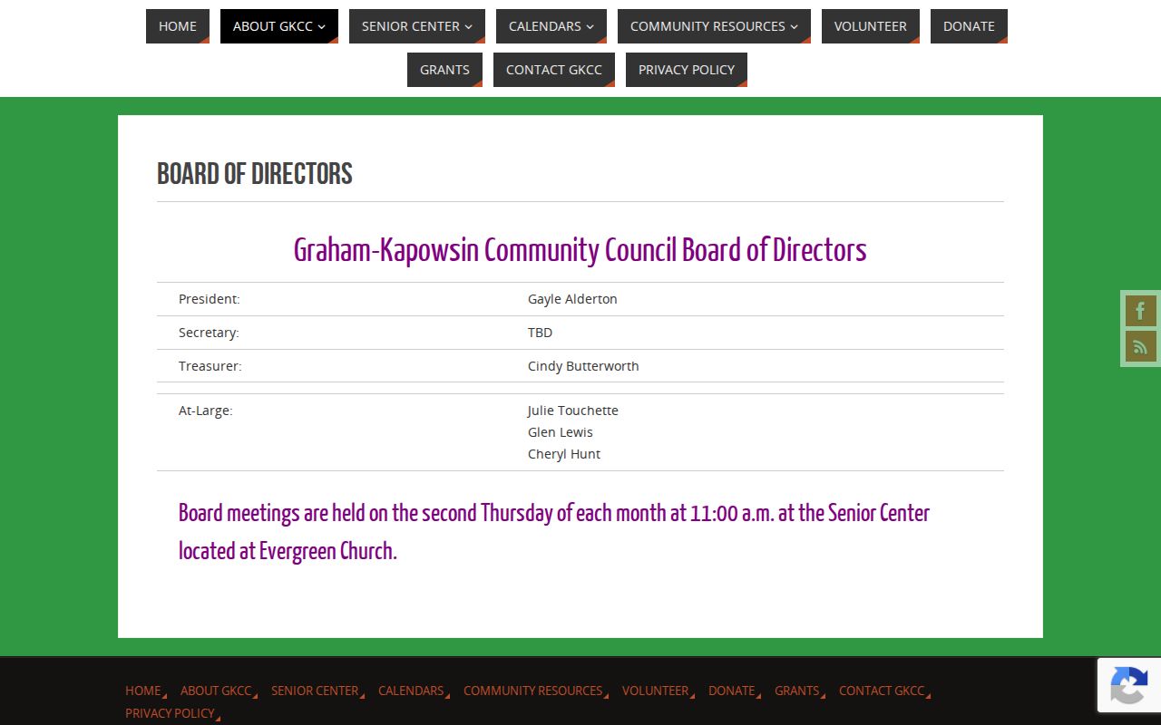
This organization layer helps locate meetings and local resources while respecting the line between public leaders and private participants.
Official Graham Neighbor Evidence
Commercial neighbor tools compile property fragments, relatives, marketing data, and address histories. Their records can be stale or merge people with similar names. Official county sources are narrower, but they state the record role and custodian. That makes them easier to verify and correct.
| Question | Official roll or map | Commercial compilation |
|---|---|---|
| Where did the name come from? | Named custodian and dated record | Source may be unclear |
| What does it prove? | Parcel, filing, permit, or voter role | Mixed household claim |
| Can it be checked? | Parcel, case, or filing identifier | Correction path varies |
| Is it current? | Source date can be saved | Update date may be vague |
Use the official record for the narrow fact it maintains. Leave non-owner household members unknown. A paywall does not make a compiled address accurate or grant permission to expose a protected person.
Past Graham Neighbors Need Context
Historical directories may let a researcher move from an address to a listed householder, but rural Graham coverage must be checked year by year. Regional Tacoma and suburban volumes may use a postal place, route, or nearby community name rather than Graham. Pair an old entry with a parcel, plat, deed, newspaper, or census date before placing it on a modern block.
The Pierce County Historical Documents Survey indexes maps, plats, photographs, newspapers, diaries, oral histories, and architectural drawings from unincorporated communities. It can provide block context that a modern tax card lacks. Historical evidence is dated evidence. It should never be presented as a current list of neighbors.
Old and new addresses may not align. A rural route, subdivision name, postal city, and county situs can all describe the same area in different ways. No dated, Graham-wide street renumbering project was verified in the research. Bridge a suspected change with parcel geometry, legal description, plat, road-name variants, and directory year instead of inventing a conversion.
Privacy for Graham Neighbors
A public block still contains private people. Parcel maps do not disclose renters, children, guests, utility or delivery customers, DMV data, protected voters, sealed court parties, or private association members. Washington's Address Confidentiality Program supplies qualifying survivors and certain threatened workers with a substitute address. The actual address remains protected.
Correct parcel errors with the Assessor using the parcel number. Ask PALS about its own case data and Elections about voter-request treatment. Do not circulate a suspected protected address while asking an office to review it. Each custodian controls correction and redaction for its own record.
Lawful use. Look up Graham neighbors for civic awareness, block history, or personal safety. Never use public names or addresses to watch, intimidate, harass, or harm anyone.