
Graham ZIP Directory Coverage
USPS identifies 98338 as the verified Graham postal starting point. Other nearby ZIP codes are candidates at the edges, not confirmed coverage for every Graham CDP parcel. No official polygon-to-ZIP table was found for the whole Census-designated place, so each edge address must be checked through the USPS address lookup and Pierce County mapping.
| Postal Code | Areas Covered | Post Office | Notes |
|---|---|---|---|
| 98338 | Graham postal city and primary Graham CDP ZIP | Graham Post Office | Verified starting point; check each full address |
| 98344 | Kapowsin postal area near Graham | Kapowsin Post Office | Exact CDP overlap not established |
| 98360 | Orting postal area near the Graham edge | Orting Post Office | Do not assign to Graham without USPS result |
| 98387 | South Pierce rural area near Graham | Varies by address | Candidate edge ZIP only |
| 98373 | Puyallup-area postal candidate | Puyallup-area office | Verify at street level |
| 98391 | South and east Pierce candidate | Bonney Lake or South Pierce area | Not confirmed as Graham CDP |
The Graham Post Office is at 10102 224th St E, Graham, WA 98338-9997. Research records list weekday retail service from 9 a.m. to 5 p.m. and round-the-clock post-office-box access. These details describe the office, not the reach of every carrier route.
USPS Verifies Graham Postal Codes
The official USPS postal lookup has three useful modes. “By Address” accepts a street with city and state or a street with ZIP. “By City and State” can return the codes recognized for a city label. “Cities by ZIP” returns postal city names tied to a code. A result validates postal formatting; USPS warns that it does not confirm a person or company.
| Lookup mode | Required entry | Best Graham use | What it cannot prove |
|---|---|---|---|
| By Address | Street plus city/state or ZIP | Verify the complete delivery line and ZIP+4 | Who lives there |
| By City and State | City and state | See postal codes recognized for Graham | CDP or parcel boundary |
| Cities by ZIP | Five-digit ZIP | Check accepted postal city labels | County jurisdiction |
The monthly USPS City State Product is the underlying city-and-ZIP validation source. Preserve both the submitted address and normalized result in research notes. That makes a later spelling, suffix, or ZIP+4 change visible.
Postal verification should be repeated when a record shows a new unit, rural-route form, or mailing city. A clean USPS result resolves delivery syntax only. It does not replace the dated county situs carried on a parcel card.
The official Graham Post Office listing is shown below.
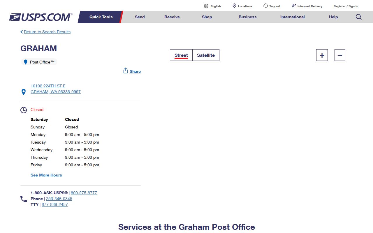
The listing anchors 98338 to a real postal facility while leaving individual street delivery to the full-address lookup.
Nearby Graham ZIP Candidates
Kapowsin, Orting, Puyallup, Bonney Lake, and rural South Pierce postal labels sit close enough to create false certainty in a postal directory. A result under 98344, 98360, 98373, 98387, or 98391 may be geographically near Graham without lying inside the Graham CDP. Reverse logic also fails: a Graham mailing label does not by itself establish CDP membership.
Use the complete street line with USPS, not a map pin or a city-name guess. Then find the parcel in PublicGIS. The map can answer county, parcel, planning, school, safety, and utility questions when the proper layers are active. It still cannot certify a postal delivery route, which is why the two-source check matters.
Boundary check. Treat every nearby ZIP as a candidate until USPS verifies the address and Pierce County GIS fixes the parcel's jurisdiction.
Find Graham Records by Postal Code
A postal code can narrow names in a directory or define a voter-data request, but the research did not confirm a public ZIP-wide resident search in ATIP or VoteWA. Begin with postal verification. Then use the parcel and the correct custodian rather than claiming that one filter produces all Graham residents.
- Run the full address through USPS. Save the recognized postal city, five-digit ZIP, and ZIP+4 if returned.
- Search the site address in ATIP. Save the parcel number, situs, and owner or taxpayer role without treating it as occupancy proof.
- Open the parcel in PublicGIS. Compare the CDP, road, district, and service layers needed for the question.
- For voter data, use a state or Pierce Elections request product and specify the geographic product offered. VoteWA is only the registrant's self-service account.
- Once the code narrows to a road, switch to the Graham street directory for parcel-by-parcel work.
Write down where each geography came from. USPS controls delivery, Pierce County controls local land and permit records, and election districts come from election data. A single number should never stand in for all three.
Graham ZIP Address Roles Differ
A property can carry several address identities at once. The situs address is the physical site. The assessor's mailing or delivery line is where tax notices go and may be outside Graham. The deed's legal description identifies land by lot, block, subdivision, or metes and bounds. USPS adds the postal city and ZIP for delivery. None should overwrite the others in a research log.
This is especially useful when the owner label is a trust, company, lender, or estate. A remote mailing line may locate correspondence, but it does not show that a named person occupies either address. Keep record role, source date, and parcel number beside the text.
- Five-digit ZIP
- A USPS delivery code, not a legal boundary.
- ZIP+4
- Four added digits that refine a delivery segment, not a public person identifier.
- PO-box ZIP
- A code or delivery pattern serving post-office boxes rather than a physical home address.
- Unique ZIP
- A code assigned to one high-volume organization or site.
- Carrier route
- A postal delivery path that may cross other civic boundaries.
Graham E911 Is Not Postal ZIP
Pierce County uses an E911 addressing grid for unincorporated Graham. County materials trace it to Ordinance 84-152 and tie a new site address to the building-permit process. An E911-only address can exist for a vacant parcel before it becomes mail-valid. County addressing materials list Debra May at 253-798-3684 for questions.
USPS makes the final delivery decision. County Google geocoding updates monthly, but a map result should not replace the postal lookup. A post-office box is a mailing destination, not the physical situs or deed description, and an association cannot create a phantom postal address. A strong Graham postal directory preserves both county and USPS results.
Graham ZIP Voter Data Limits
VoteWA asks a registrant for a matching first name, last name, date of birth, and verification controls. It lets that voter view or update an account. It is not a public ZIP-wide lookup. State and county voter extracts are request products that may offer active voter, history, district, precinct, or other current product choices.
The state VRDB request collects requester contact and address fields, including ZIP and county, plus a description of the data sought. That requester ZIP is not evidence that the output can always be filtered to Graham by postal code. Pierce County has a separate district, precinct, and matchback form. Both routes have statutory use limits, and protected voter addresses are excluded or substituted.
Note: Washington has no party registration, and voter participation history never reveals a person's ballot choices.
Old Graham ZIP Labels Shift
Historical directories and newspapers may use Tacoma suburban, rural-route, subdivision, Kapowsin-area, Orting, Puyallup, or county labels for a place now associated with Graham. Preserve the original wording. Searching only the current postal city can hide a useful address entry even when the family or parcel stayed in the same general area.
Translate an old label with a plat, legal description, road map, parcel geometry, deed, or later directory. Do not force a modern ZIP onto a record created before that label applied. The regional nature of Graham's directory history makes this one of the most useful local checks.
Graham Postal Codes Versus CDP
Graham has no city limit because it is unincorporated. The Census CDP is a statistical boundary, the postal code serves mail, and Pierce County remains the government jurisdiction for most parcels, roads, permits, taxes, and courts. Those areas can overlap without matching. A “Graham, WA 98338” delivery line does not prove that a parcel lies inside the CDP, just as a nearby postal city does not move the parcel out of county control.
For a precise result, use USPS for delivery, PublicGIS or Census geography for the CDP, ATIP for the parcel, and PALS for county site records. This division of labor is the central rule of the Graham postal directory.
- Postal geography
- The delivery labels and routes maintained by USPS.
- Census CDP
- A statistical place boundary used for population reporting, not a city government.
- County jurisdiction
- The public authority that keeps Graham land, tax, permit, and many local records.
- Parcel boundary
- The mapped limits of one tax and land account.